Basin Water Organization “Amu Darya”
Briefly about the basin
Basin Water Organization “Amu Darya” is an executive and inter-ministerial body of ICWC which is responsible for water delivery within the agreed water withdrawal limits in the Amu Darya River Basin.
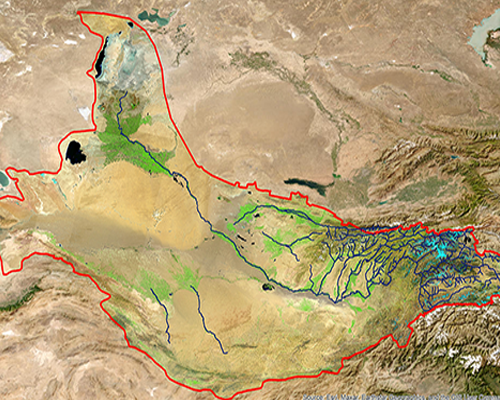
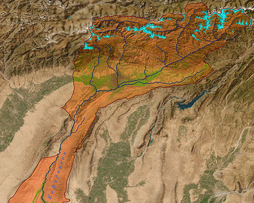
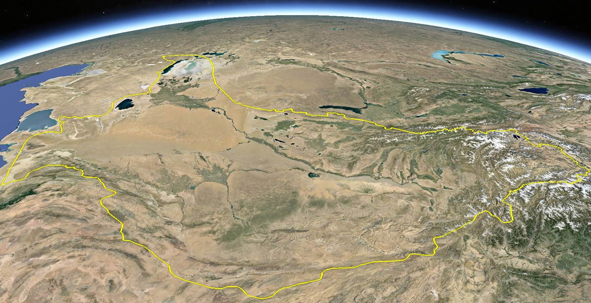
Amu Darya River basin with total area 1017.8 thousands km2 is located on territory of closed, isolated from oceans Aral Sea region without inflow.
Amu Darya River basin covers totally territory of Turkmenistan and part of Tajikistan and Uzbekistan, Kyrgyzstan and Afghanistan.
Amu Darya is the largest river in catchment area and water availability in Central Asia and is formed by Panj and Vakhsh rivers conjunction. Its total length from Panj River head to Aral Sea is 2574 km, from conjunction place 1415 km.
Panj River almost along all length passes border between Tajikistan and Afghanistan.
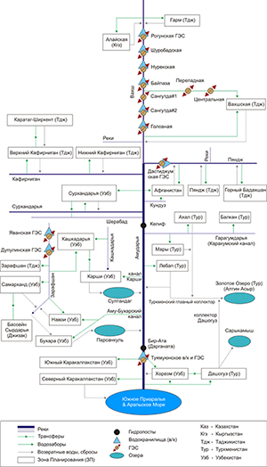
Amu Darya River receives tributaries only within first 180 km. Within 12 km from Panj and Vakhsh conjunction place Kunduz River (Afganistan) inflows from the left, within 38 km from the right Kafirnigan River, within 137 km Surkhandarya River, within 180 km Sherabad River.
Amu Darya River basin is the largest in area and water availability in this region.
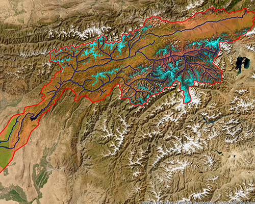
Amu Darya belongs to rivers with glacier-snow inflow, area of glaciers on right-bank water catchment areas is 7.3 thousands km2. Water catchment area is 226.8 thousands km2.
ithin Amu Darya basin complex irrigation system is created that counts significant quantity of canals, pumping stations, collectors, and irrigation spillways.
On average basin irrigated area is 3.8-4.0 th. ha
With account of morphologous and geographic peculiarities Amu Darya basin is divided into 3 reaches: upper (upstream Kelif gauging station border between Turkmenistan and Uzbekistan); middle (between Kelif and Tuyamuyun gauging stations), and lower (downstream Tuyamuyun).
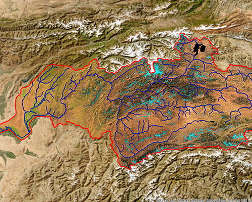
In upper reaches lands of Tajikistan, Uzbekistan (Surkhandarya oblast), and Kyrgyzstan (small irrigated massif in the south of the republic) are irrigated. In upper reaches irrigated massifs are located in valleys of Amu Darya basic elements and tributaries: Panj, Vakhsh, Kafirnigan, Surkhandarya, and Sherabad.
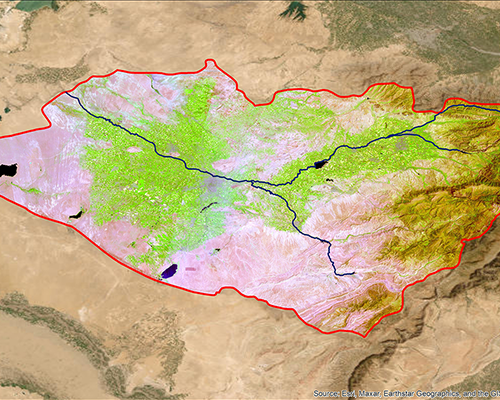
In middle reaches largest massifs of present irrigation are concentrated on canals of big length, such as Garagum, Karshi Main Canal with cascade consisted of 6 pumping stations, Amu-Bukhara Canal. In each canal system some water reservoirs function. Irrigation systems from Kelif to Tuyamuyun receive water by means of dozen canals with water intake without dam.
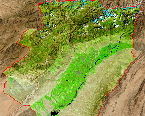
In lower reaches on both riverbanks big canal system are constructed: Tashsaka, Pakhtaarna, Klychniyazbay, Urgench-Oktyabr-arna, Khan-yab (Sovet-yab), Kyzytken, Suenli.
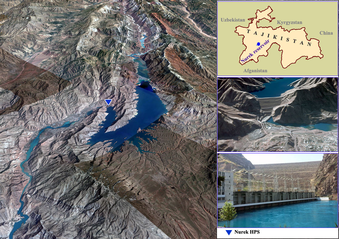
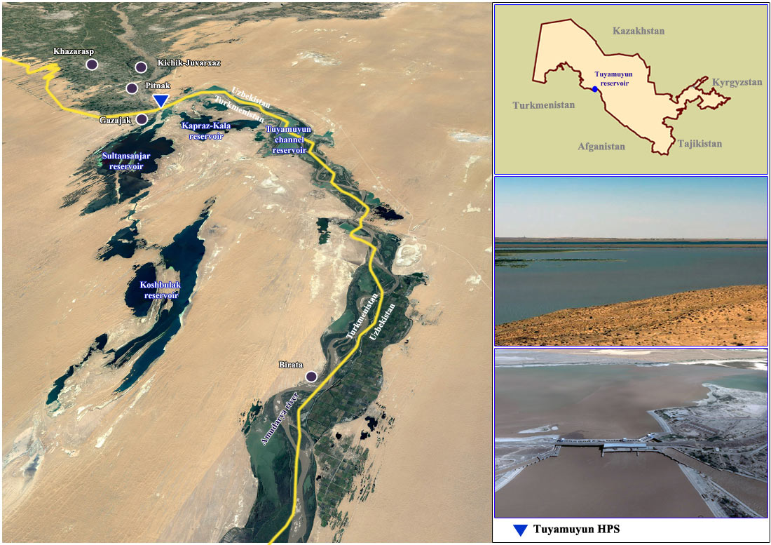
In Amu Darya basin there are two large river seasonal storage reservoirs: Nurek on Vakhsh River, Tuyamuyun in lower reaches and dozen of in-basin and in-system reservoirs.
Nurek reservoir and HPS
Tuyamuyun hydroscheme
Basic source providing water demands of agricultural sectors in Amu Darya basin, in particular, most water consumptive sector, irrigated agriculture, is surface water resources river flow (its average multiyear volume is 78.4 km3/year including Amu Darya flow 62.1 km3/year).
Background
In Soviet times till 1987 main role in regulation in and management belonged to USSR Minvodkhoz, republican Minvodkhozes, and UPRADIK (water organization of USSR Minvodkhoz, which is directly subordinated to it, fulfills republican water allocation in lower reaches on base of principles of strict objectiveness. It is located in Urgench). Presently Upradik is part of BWO “Amu Darya” structure.
By the end of 80-s traditional form of water management in Aral Sea basin had exhausted own potential and started to malfunction in operational management. Therefore according to proposal of republican governments on August 27, 1987 by order of USSR Minvodkhoz Amu Darya Basin Division was created in Urgench. It was organization on inter-republican water allocation (Uprvodkhoz “Amu Darya”). It was established to improve and increase water management effectiveness within basin by means of transition to basin management principles as well as to provide more operative and actual solution of agricultural problems. Further this division was renamed to Basin Water Organization (BWO) “Amu Darya”.
According to common arrangement with basin states BWO “Amu Darya” should serve and manage main river trunks:
• Panj River trunk;
• Vakhsh River trunk;
• Kafirnigan River trunk;
• Amu Darya River trunk from the beginning to Aral Sea as well as management and operation of interstate main canals with structures located in Amu Darya lower reaches downstream Tuyamuyun hydrounit.
BWO should control all pumping stations in trunk of rivers Amu Darya, Panj, Vakhsh, Kafirnigan and on interstate canals as well as part of river water intakes not transferred to BWO this is Dangara hydrounit at Vakhsh River, Karakum Canal, and Tuyamuyun hydrounit with reservoirs at Amu Darya River..
During next two years Tajikistan, Turkmenistan, and Uzbekistan transferred to BWO for temporary use 84 hydrotechnical structures (from them 36 head water intakes), 169 gauging stations, 386 km of interstate canals as well as big quantity communication means for operational needs (roads, communication, power supply, technical means, etc.).
Water resources management
Main water management structure is divided into three levels with subordination of lower levels to upper ones in following way:
1. At first hierarchic level BWO (board) takes place directly subordinating to ICWC and decides issues of planning, management, regulation and water allocation among states.
In information aspect BWO is connected with Minselvodkhozes, Minvodkhozes, SIC ICWC, and hydromets of Central-Asian states.
2. Second level is presented by four territorial hydrounit divisions, which supply water to water users according water intake limits plan approved by BWO. Each division includes water sector objects providing water resources delivery, formation, and use within territories' borders.
Territorial divisions are subordinated directly to BWO board.
3. Third level control and management stations (CMS). They are hydrostructures, gauging stations under divisions' operation.
Between BWO board and these divisions operational-supervision communication is organized day and night on rented telephone channels, on radio links.
According to general agreement of the Central Asian states, the interstate water management and distribution covers only main channels of the following rivers: the Panj, the Vakhsh, the Kafirnigan, and the Amu Darya itself.
or the purposes of surface natural water management, the Central Asian states transferred to BWO for temporal usage the head intakes along the Amu Darya and its main tributaries and the canals with structures of interstate importance.
BWO also controls: part of head intakes that were not transferred completely, all pumping stations diverting water from river main streams and main interstate canals, river reservoirs, key hydroposts, and spills of return water into the river channel.
Four territorial divisions for the operation of water intake structures, hydroschemes, and interstate canals were established under BWO Amu Darya with the centers in Kurgan-Tyube (Republic of Tajikistan), Turkmenabad (Turkmenistan), Urgench (Republic of Uzbekistan), Takhiatash (Republic of Karakalpakstan) so that BWO could manage transboundary water resources.
Each territorial division is responsible for specific river reaches or rivers:
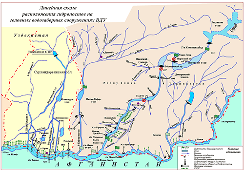
Upper Darya Division perates intake structures, controls water intakes from the Vakhsh, Panj, and Kafirnigan rivers and on the Amu Darya River 246 km reach up to the Kelif hydropost (Upper reaches).
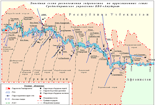
Middle Darya Division controls water intakes at the Amu Darya River 552 km reach from the Kelif to Darganata hydroposts (Middle reaches).
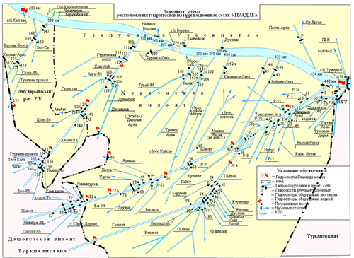
Amu Darya Inter-republican Canals Division (Upradik) operates 11 river intake structures and 52 hydrostructures on main canals, 337 km of main canals, controls water intakes within river 167 km reach from the Tuyamuyun hydroscheme to the Kipchak hydropost (Lower reaches). Upradik manages three large-scale irrigation systems: Tashsaka, Klychniyazbai and Kipchak-Bozsu
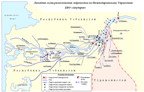
Lower Darya Division operates Takhiatash hydroscheme, head water intakes of canals Khan-yab and Jumabaysaka, controls all water intakes from river within 283 km reach from Kypchak hydropost to the Aral Sea (Lower reaches).
The practice of interstate water limit allocation is maintained in the Amu Darya Basin
The limits of country water withdrawals are the agreed by all states quantities of water withdrawal for each state, the Aral Sea, and Prearalie. The Parties' limits of water withdrawal are set by ICWC. In total, the allocated limits in the basin amount to 59.45 km3 in a hydrological year.
Regarding the Aral Sea and river basins, the organizational framework for interaction between the interstate water management bodies and with national agencies are coordinated with the IFAS framework through the ICWC and its executive bodies (such as the BWOs and the SIC). These provide the main channels of interstate cooperation.
The legal basis of the shared water management and distribution in the Aral Sea basin is laid by the Agreement on Cooperation in the Field of Joint Management of the Use and Conservation of Water Resources in Interstate Sources (Almaty, 1992) and also by other documents and acts adopted by the Central Asian countries for individual river basins based on earlier agreed schemes of water allocation.
BWO Amu Darya in its activity is guided by its Statute approved by ICWC, the acting legislations of the ICWC member-countries, as well as ICWC decisions, agreements, protocols and other regulations.
The organization is financed through contributions from the three states (Uzbekistan, Tajikistan, and Turkmenistan).
It should be noted that, based on forecast and the current water-related situation in the region, the following water allocation options are approved at ICWC meetings:
1. In the period of normal water availability and if water storage is available in reservoirs, water allocation is made according to the approved limits of water withdrawals.
2. In a low-water period, Article 4 of the Almaty Agreement 1992 is applied, and the following criteria for interstate use of the established water withdrawal limits are set:
• if water content is below the design one, water withdrawals of the states should be corrected according to an ICWC decision;
• in case of water shortage in the basin over a certain period of time, the Basin Water Organization Amu Darya applies a percentage-based allocation of water among water consumers;
• he percentage shares of water allocation are set based on the ICWC-established limits of water withdrawals for the whole period of time for key water consumers.
For more effective distribution of water resources, relief of water-related tension, and building trust among water consumers in the river's lower reaches, the water ministers of Turkmenistan and Uzbekistan, proceeding from a need for optimal flow management and operational solution of water distribution issues in the lower reaches of the Amu Darya River, signed in May 2007 the “Agreement on joint water use by Turkmenistan and the Republic of Uzbekistan in the Amu Darya lower reaches”.
The respective commission has being met since 2002. By September 2017, 172 meetings of the joint commission for water allocation in the Amu Darya lower reaches were held, with participation of the heads of PO “Dashoguzsuvkhojalyk” (Turkmenistan), Lower-Amu Darya BISA (Karakalpakstan and Khorezm), BWO Amu Darya, and Operation Division of Tuyamuyun Hydroscheme. The meetings developed operation regimes of the Tuyamuyun Hydroscheme, and water resources were distributed according to achieved agreements. Such approach to water distribution in the Amu Darya lower reaches suits all parties.
The monitoring of river water plays a key role in the region both in low-water and high-water periods. At present, regular monitoring is maintained only in the reach from the Aral Sea to Termez hydropost that is 1,277 km long or accounts for approx. 70% of the river's length. Roughly since 1992, no information has been available from hydroposts located along the Panj, Vakhsh, and Kafirnigan rivers. This has a negative effect on reliability of short-term planning and forecasting. Currently, to make somehow an assessment of the water-related situation and the expected inflow at the border of the two main water consumers (Turkmenistan and Uzbekistan) and take preventive measures, the level-measuring Termez hydropost (1,277 km) serves as a key one.
